


Portland City (Northwest & Southwest) PUMA, Oregon
About
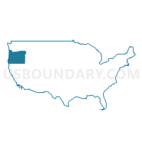
Outline
+PUMA%2c+Oregon_A280.png)
Summary
| Unique Area Identifier | 193832 |
| Name | Portland City (Northwest & Southwest) PUMA |
| State | Oregon |
| Area (square miles) | 106.84 |
| Land Area (square miles) | 99.66 |
| Water Area (square miles) | 7.18 |
| % of Land Area | 93.28 |
| % of Water Area | 6.72 |
| Latitude of the Internal Point | 45.60293120 |
| Longtitude of the Internal Point | -122.80390810 |
Maps
+PUMA in Oregon.png)
Graphs
Select a template below for downloading or customizing gragh for Portland City (Northwest & Southwest) PUMA, Oregon
+PUMA%2c+Oregon_T0.png)
+PUMA%2c+Oregon_T1.png)
+PUMA%2c+Oregon_T2.png)
+PUMA%2c+Oregon_T3.png)
+PUMA%2c+Oregon_T4.png)
+PUMA%2c+Oregon_T5.png)
+PUMA%2c+Oregon_T6.png)
+PUMA%2c+Oregon_T7.png)
+PUMA%2c+Oregon.png)
Neighbors
Neighoring Public Use Microdata Area (by Name) Neighboring Public Use Microdata Area on the Map
- Clackamas County (Northwest)--Lake Oswego, West Linn, Wilsonville & Canby Cities PUMA, OR
- Clackamas County (Northwest)--Oregon City, Milwaukie & Happy Valley Cities PUMA, OR
- Clark County (Southwest)--Vancouver City (West & Central) PUMA, WA
- Columbia, Lincoln, Clatsop & Tillamook Counties PUMA, OR
- Portland City (Central East) PUMA, OR
- Portland City (North & Northeast) PUMA, OR
- Portland City (Southeast) PUMA, OR
- Washington County (Northeast)--Beaverton City (East & Central) & Cedar Mill PUMA, OR
- Washington County (Southeast)--Tigard, Tualatin & Sherwood Cities PUMA, OR
- Washington County (West)--Forest Grove, Cornelius Cities, Bethany & Oak Hills PUMA, OR
Top 10 Neighboring County (by Population) Neighboring County on the Map
- Multnomah County, OR (735,334)
- Washington County, OR (529,710)
- Clark County, WA (425,363)
- Clackamas County, OR (375,992)
- Columbia County, OR (49,351)
Top 10 Neighboring County Subdivision (by Population) Neighboring County Subdivision on the Map
- Portland East CCD, Multnomah County, OR (462,994)
- Beaverton-Hillsboro CCD, Washington County, OR (404,973)
- Northwest Clackamas CCD, Clackamas County, OR (248,731)
- Vancouver CCD, Clark County, WA (219,580)
- Portland West CCD, Multnomah County, OR (125,084)
- Rockcreek CCD, Washington County, OR (69,001)
- Scappoose CCD, Columbia County, OR (9,504)
- North Plains CCD, Washington County, OR (4,800)
- Skyline CCD, Multnomah County, OR (2,759)
Top 10 Neighboring Place (by Population) Neighboring Place on the Map
- Portland city, OR (583,776)
- Vancouver city, WA (161,791)
- Beaverton city, OR (89,803)
- Tigard city, OR (48,035)
- Lake Oswego city, OR (36,619)
- Bethany CDP, OR (20,646)
- Cedar Mill CDP, OR (14,546)
- West Haven-Sylvan CDP, OR (8,001)
- Garden Home-Whitford CDP, OR (6,674)
- West Slope CDP, OR (6,554)
Top 10 Neighboring Unified School District (by Population) Neighboring Unified School District on the Map
- Portland School District 1J, OR (459,982)
- Beaverton School District 48J, OR (255,082)
- Vancouver Public Schools, WA (142,811)
- Hillsboro School District 1J, OR (125,462)
- North Clackamas School District 12, OR (113,237)
- Tigard-Tualatin School District 23J, OR (78,274)
- Lake Oswego School District 7J, OR (40,616)
- Scappoose School District 1J, OR (14,486)
- Rainier School District 13, OR (7,405)
- Riverdale School District 51J, OR (2,831)
Top 10 Neighboring State Legislative District Lower Chamber (by Population) Neighboring State Legislative District Lower Chamber on the Map
- State House District 49, WA (134,779)
- State House District 33, OR (79,509)
- State House District 35, OR (65,721)
- State House District 34, OR (65,504)
- State House District 36, OR (63,722)
- State House District 31, OR (62,690)
- State House District 44, OR (62,330)
- State House District 27, OR (62,120)
- State House District 32, OR (60,293)
- State House District 41, OR (59,890)
Top 10 Neighboring State Legislative District Upper Chamber (by Population) Neighboring State Legislative District Upper Chamber on the Map
- State Senate District 17, OR (145,013)
- State Senate District 49, WA (134,779)
- State Senate District 18, OR (129,443)
- State Senate District 14, OR (126,140)
- State Senate District 16, OR (122,983)
- State Senate District 19, OR (121,745)
- State Senate District 22, OR (120,987)
- State Senate District 21, OR (118,917)
Top 10 Neighboring 111th Congressional District (by Population) Neighboring 111th Congressional District on the Map
- Congressional District 1, OR (802,570)
- Congressional District 3, WA (779,348)
- Congressional District 3, OR (762,155)
- Congressional District 5, OR (757,128)
Top 10 Neighboring Census Tract (by Population) Neighboring Census Tract on the Map
- Census Tract 315.13, Washington County, OR (11,399)
- Census Tract 70, Multnomah County, OR (8,181)
- Census Tract 51, Multnomah County, OR (7,926)
- Census Tract 301.01, Washington County, OR (7,544)
- Census Tract 315.08, Washington County, OR (7,507)
- Census Tract 41.01, Multnomah County, OR (7,215)
- Census Tract 1, Multnomah County, OR (5,927)
- Census Tract 65.01, Multnomah County, OR (5,898)
- Census Tract 40.02, Multnomah County, OR (5,802)
- Census Tract 59, Multnomah County, OR (5,800)
Top 10 Neighboring 5-Digit ZIP Code Tabulation Area (by Population) Neighboring 5-Digit ZIP Code Tabulation Area on the Map
- 97229, OR (58,217)
- 97124, OR (48,349)
- 97223, OR (46,699)
- 97202, OR (38,762)
- 97219, OR (38,709)
- 97222, OR (34,979)
- 97217, OR (31,438)
- 97203, OR (31,042)
- 97225, OR (24,176)
- 97035, OR (23,912)